

Croaghnamaddy [Cruach na Madadh]
Good walks are even better shared.
Overview
Overview
Croaghnamaddy, or Cruach na Madadh, is a delightful gem nestled in Connemara, Ireland. Standing proudly at 646 meters, this Marilyn invites adventurous souls to explore its rugged beauty.
Geology
The mountain's rocks tell a tale of ancient marine environments shaped by the relentless forces of nature. Sedimentary strata dominate the landscape, offering a peek into a time long before humans roamed the earth.
Routes
One of the best-loved trails starts from Letterfrack, leading you through enchanting woodlands that seem to whisper tales as you walk. As you ascend, the views grow increasingly breathtaking, with a summit that rewards your efforts handsomely.
Summit Features
At the top, you'll find a small, charming cairn where you can take that all-important summit photo. Don't forget to tell your friends you risked life and limb (okay, maybe just a small hill) to get there!
Terrain
Expect a mix of rocky paths, soft grassy patches, and the occasional bog that might munch on your boots if you're careless. A solid pair of hiking shoes is your best friend here.
Views
The summit is a vantage point unlike any other. With the Twelve Bens rising majestically and Killary Harbour's waters twinkling in the distance, it's a photographer's paradise. Aim for late spring or early autumn for views that are simply out of this world.
Hazards
Be mindful of rapidly changing weather; it's not just a saying here. Keep an eye on the sky, and make sure your gear is waterproof because no one enjoys a soggy sandwich. The trails can be slippery due to mud, so tread carefully.
Nearby Summits
If you're feeling particularly enthusiastic, consider bagging the nearby Benbaun or Bencorr. Just be sure you've packed enough snacks; you wouldn't want to run out before you claim your next summit!
Access
Parking is a breeze in Letterfrack, with ample spaces available to securely leave your vehicle. For those relying on public transport, buses from Galway make the commute quite manageable.
Facilities
After your hike, you can reward yourself with a well-deserved treat at one of Letterfrack's charming cafes or restrooms.
History
The name Croaghnamaddy speaks to its rich Gaelic heritage, while the surrounding area boasts historical significance through its connection to local folklore and clans. It’s a hill that holds onto its stories as tenaciously as it holds onto its rocks.
Conclusion
With its impeccable views, challenging but rewarding terrain, and rich tapestry of history, Croaghnamaddy is not just a hill – it's an experience waiting to be had. So, lace up your boots, grab that camera, and let the adventure unfold!
Explore routes near Croaghnamaddy [Cruach na Madadh]
Public walks starting within 80 km of this hill. Nearby does not mean a route reaches the summit; check its map and access before setting out.
Derry~Londonderry City Walls Circuit
View route
Banagher Glen and Forest: complete higher-return circuit
View route
Route planning notes
These notes describe possible approaches, not verified navigable routes or permission to cross land. Check current paths, local access rules and conditions before setting out.
Loop from Letterfrack
This scenic loop offers hikers a delightful mix of challenging terrain with stunning views. Starting from Letterfrack, the route takes you through beautiful woodlands before ascending towards the summit.
Make a day of it, together
Find someone to share the walk with, or organise a day out along a route you like.
Photo Gallery
View all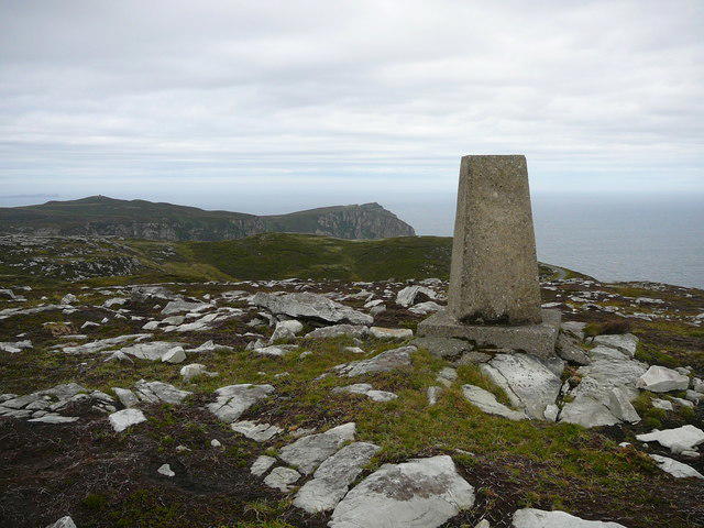 Photo could not load
C0240 : The trig point on Croaghnamaddy 252 metres
Colin Park
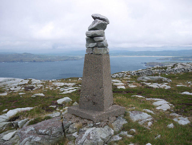 Photo could not load
C0240 : Croaghnamaddy Triangulation Pillar
Rossographer
Hill facts and local notes
Classifications
Elevation
252m
827 ft
Prominence
247m
Coordinates
55.2089, -7.9552
C029402
OS Map
02
At the Summit
The summit features a small stone cairn, which some have been known to use as a backdrop for 'I climbed this!' selfies.
Terrain & Geology
The mountain is primarily composed of sedimentary rocks, including sandstone and shale, resulting from ancient marine environments. Its rugged terrain reflects a long history of glacial activity that has shaped the landscape.
Views & Scenery
From the summit, hikers will enjoy breathtaking views of the surrounding Twelve Bens mountain range, Kylemore Abbey, and the shimmering waters of Killary Harbour.
History & Heritage
Name Origin
Croaghnamaddy derives from the Irish 'Cruach na Madadh,' meaning 'the hill of the dogs,' possibly linked to local folklore or wildlife.
Historical Significance
The area holds cultural significance due to its proximity to historical sites such as Kylemore Abbey and the tradition of Gaelic clans.
Getting There & Facilities
Check current local access restrictions, parking rules and transport timetables before travelling. These notes do not confirm public access to the summit.
Parking
There is ample parking available in Letterfrack, where you can leave your vehicle while you embark on your adventure.
Public Transport
Bus services run regularly from Galway to Letterfrack, making it accessible for those who prefer not to drive.
Nearby Facilities
Letterfrack has a few local cafes for a quick bite post-hike, as well as public toilets.
Safety Information
Known Hazards
- Weather conditions can change rapidly; bring suitable gear. The terrain can be slippery and boggy, especially after rain.
General Safety Tips
- Check weather conditions before setting out
- Carry appropriate clothing and equipment
- Let someone know your planned route
- Take a map, compass, and GPS device
- Carry emergency supplies: food, water, first aid kit, torch
Hills
Some common questions about the hills answered
Are there group walks up Croaghnamaddy [Cruach na Madadh]?
Many walkers use Walkmates to join or organise walks with others. You can check for group walks around Croaghnamaddy [Cruach na Madadh] through the maps
Are there other walkers around Croaghnamaddy [Cruach na Madadh]?
Activity varies by location and time, but Walkmates lets you see whether others have shared walks or shown interest in this area. Find other people through the walking friends search walking friends for Croaghnamaddy [Cruach na Madadh] search or of course create your own walk for Croaghnamaddy [Cruach na Madadh]
Can I organise a walk to Croaghnamaddy [Cruach na Madadh]?
Yes. If there aren’t any walks listed already, you can create a walk and make it available for others to join.
If you're signed up to Walkmates, you can create a walk to Croaghnamaddy [Cruach na Madadh].
How do I find a walk up this hill?
There are often multiple ways to walk this hill, depending on experience and route preference. Walkmates helps you explore walks and routes that others have shared.
Can I suggest a new route up Croaghnamaddy [Cruach na Madadh]?
Yes. You can suggest or create routes to share with others. Walkmates focuses on the social side of walking, so routes are used to help people organise walks and explore areas together, rather than as detailed navigation tools or route libraries.
Other uses really appreciate knowledgeable walkers sharing their routes. Share your favourite route to Croaghnamaddy [Cruach na Madadh] here
The is an error or something incorrect about this hill. How do I let you know?
We always strive to keep the information on Walkmates as accurate as possible. If you find an error, please let us know through the contact form and we'll aim to correct it as quickly as possible
Community Discussion
Comments
Location
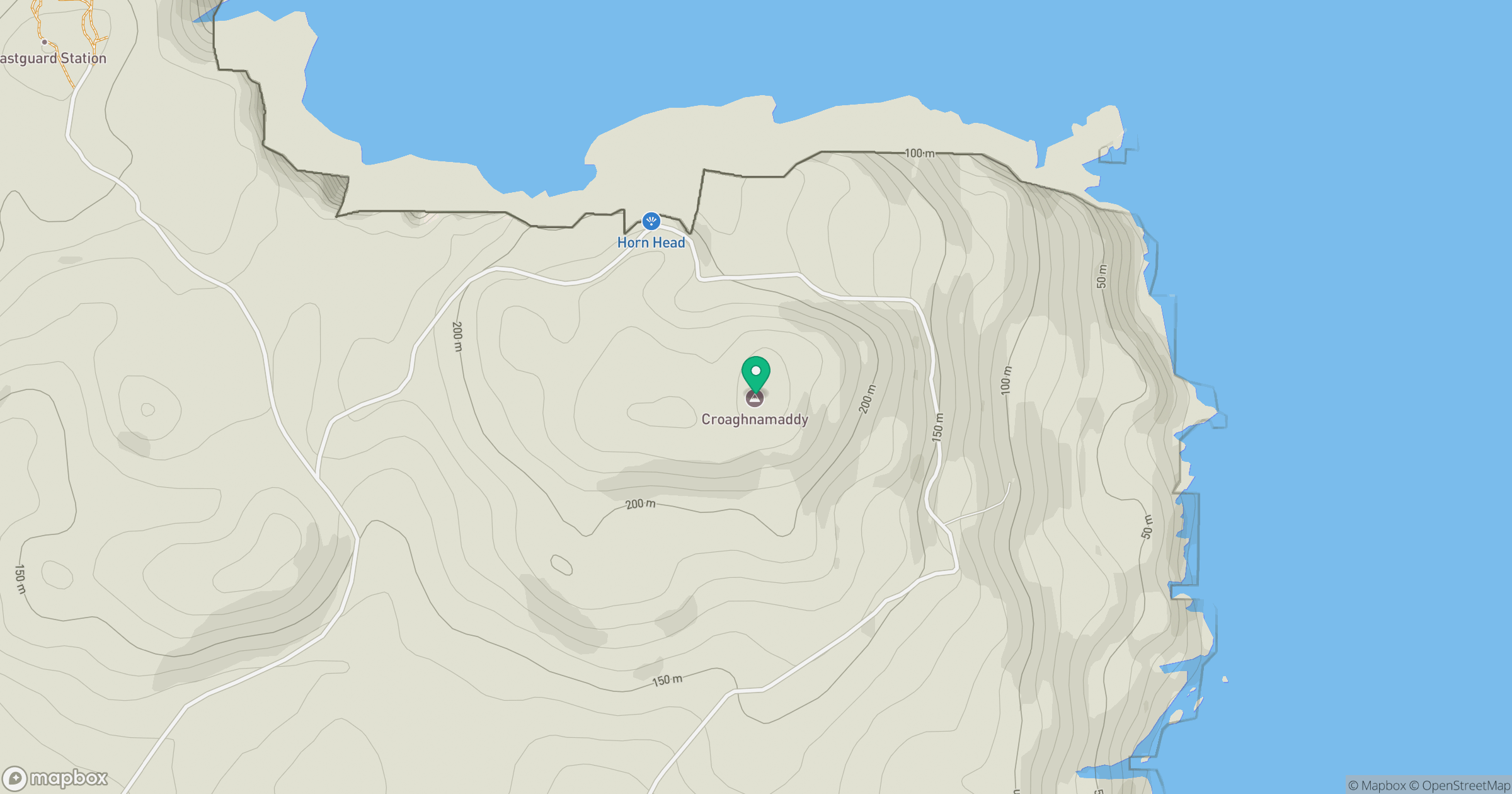
Grid reference: C029402
View on OpenStreetMapOpens a map in a new tab, centred on the hill.
Hills within 30 km
Straight-line distance, not a walking route or confirmation of access.
No comments yet. Be the first.